
CountryName: The BahamasCode: BHS Official Name: Commonwealth of the Bahamas Located: Central America and the Caribbean Capital: Nassau Calling Code: +1-242 |
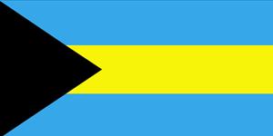
Flag of Commonwealth of the Bahamas |
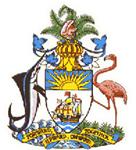
Coat of Arms of Commonwealth of the Bahamas |
Demographics and PoliticsForm of Goverment: Unitary Parliamentary democracy and constitutional monarchyOfficial Languages: English Regional Languages: Bahamian Dialect Population: 353658 Largest cities: Nassau, Lucaya, Freeport, West End, Cooper’s Town, Marsh Harbour, High Rock Religion: Protestant Christian, Baptists, Anglicans |
||
Geographic InformationArea Total: 13878.00 sq.km.Water: 28.00% Borders: Cuba, Hispaniola, Turks and Caicos Islands, United States Mountains: Rivers: Cargill Creek, Deep Creek, Goose River, Hawk Creek, Lisbon Creek Climate: Subtropical |
||
The Bahamas Famous PlacesNassau, Grand Bahama Island, San Salvador, Cat Island, Abacos, Andros |
||
The Bahamas EconomyTourism, banking, oil transshipment, salt, rum, aragonite, pharmaceuticalsCurrency: Bahamian dollar (BSD) |
||
International Driver License Commonwealth of the BahamasDo you need an International Driver License for travel? Apply for IDL Online! More about International Driver License >> Tips: Driving in a foreign Country Road Traffic InformationDrive Side: LeftConvention of Road Traffic: Viena 1968 Convention on Road Traffic, of 8 November 1968 Convención sobre la Circulación Vial en Viena el 8 de Noviembre de 1968 Конвенция о дорожном движении, подписанная в Вене 8 ноября 1968 года Convention sur la Circulation Routière fait à Vienne le 8 Novembre 1968 《道路交通公约》 1968 年11 月8 日订于维也纳 Convention on Road Traffic, of 8 November 1968 - Arabic |
||
The Bahamas Time Zone (UTC)Winter:-5 - -5Summer: -4 - -4 |
||
| Back to Country List | ||